 SITELIVE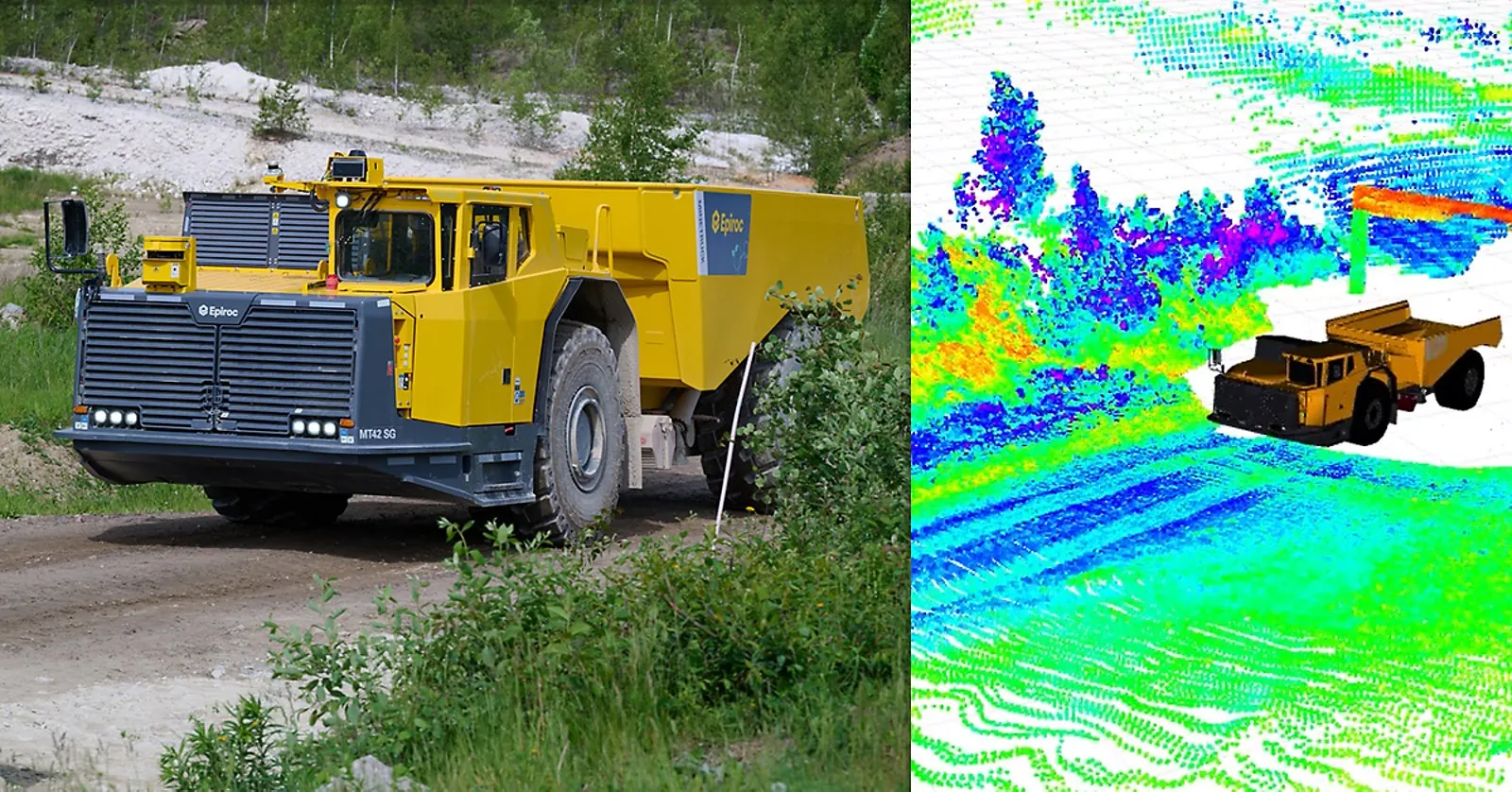
What Epiroc announced
On 3 September 2026 Epiroc’s Underground division said it is expanding the capabilities of its autonomous underground mine trucks by enabling operation in surface environments, using 3D LiDAR for localisation, mapping and obstacle detection. In the company’s words the change “enables seamless transitions between underground and surface operations using Deep Automation, paving the way for end-to-end autonomous hauling and dumping cycles.” The point is the cycle, not the truck: an underground haul that ends at a surface stockpile or waste dump has until now needed either a driver for the last leg or a transfer point where the automated section stops.
Epiroc says a live demonstration was held in June 2026 at its Epiroc World Expo customer event, where attendees also watched a battery-electric mine truck automatically detect and stop for obstacles placed in its path. The release places the work in a sequence: 3D ramp visualisation in Deep Automation, then the automation rollout for the Minetruck MT65 S, and now 3D LiDAR localisation, mapping and obstacle detection.
Why the sensor change is the story
Underground automation has had an easier localisation problem than surface autonomy for a simple reason: the drive is a corridor. A 2D laser scanner sweeping a horizontal plane sees two walls and a roof profile, and matching that against a stored map gives position without satellite navigation. Drive out of the portal and the walls disappear. Robert Lundh, an automation specialist in Epiroc’s Underground division, puts it plainly in the release: “Surface environments present unique challenges compared to underground operations due to fewer positioning references and changing weather conditions. By moving from traditional 2D sensors to a 3D LiDAR system, we improve environmental awareness and get more reliable positioning.”
A 3D LiDAR returns a point cloud of berms, stockpiles, buildings and terrain rather than a single slice, which gives the localiser more geometry to match against and lets the same sensor do obstacle detection in the volume the truck will actually occupy. It is the sensing approach surface autonomous haulage has used for years, applied to a machine class that was designed for the opposite environment. Johannes Mutamba, Epiroc’s global product manager for Deep Automation trucks, says trucks are “the natural starting point for this technology, given their long operating distances and the fact that their operating cycles often extend from underground production areas to surface dumping locations,” and that a common system for underground and surface hauling “can scale this solution to other machine types in the future.”
The honest limits
This is a capability announcement, not a deployment report. The release names no customer mine, no commercial start date, no operating speeds, no cycle counts and no availability figures. The evidence offered is a demonstration at Epiroc’s own event on Epiroc’s own ground in June. It does not say how the system handled rain, dust, snow or darkness, which is exactly the set of conditions Lundh identifies as the surface challenge, nor whether GNSS is used in combination with LiDAR on the surface leg or LiDAR alone. Whether the portal transition itself — the moment a truck loses the tunnel geometry and picks up open-air references — is handled continuously or with a stop-and-relocalise step is not described.
The regulatory side is also unaddressed. An autonomous truck on a surface haul road shares that road with light vehicles, graders, water carts and people in a way an isolated automation zone underground does not, and every jurisdiction that permits autonomous haulage on surface requires an isolation and interaction regime around it. Epiroc’s release describes built-in obstacle detection; it does not describe the site-level control system, geofencing or permit-to-enter arrangements that a real deployment would run under. None of this is a criticism of the engineering. It is a description of what a practitioner cannot yet check.
What it means for operators
For underground mines that already run automated trucks on the decline, the immediate question is whether the last leg to the surface dump can be brought inside the automation system, which removes a driver changeover, a transfer bay or a second fleet. That is worth pursuing only if the site’s surface haul road can be isolated to the standard an autonomous zone needs, so the first job is a traffic-management review, not a purchase order.
For quarry and civil operators watching from outside mining, the useful signal is that a second major OEM is now converging the underground and surface sensing stacks on 3D LiDAR. That is the sensor that also drives the localisation and mapping on small autonomous machines and on reality-capture rigs, and it means the point clouds an autonomous haul fleet generates in the course of driving are increasingly the same data a survey team would otherwise go and collect.